Hiking in Öland - Trails Across Alvar, Coast and Forest
Hiking trails on Öland at a glance, the Mörbylångaleden across the Stora Alvaret, loop trails at Trollskogen and Ottenby, best season and practical tips.
Contents
Öland is flat, and that is exactly what makes hiking here so relaxed, there are no serious climbs. Instead, the landscapes change within a short distance: the wide, steppe-like limestone heath of the Stora Alvaret in the south, storm-bent pines and ivy-clad oaks in the forests at the northern and southern tips, plus coastal meadows and shoreline. Anyone wanting to walk for several days has a dedicated long-distance trail in the Mörbylångaleden; anyone with just a few hours to spare will find short loop trails in the nature reserves. This guide sets out the main routes and what you need for them.
The Mörbylångaleden - Öland's Long-Distance Trail
The island's signature long-distance trail is the Mörbylångaleden. It is more than 80 kilometres long (around 83 km) and runs from the Öland tourist office in Färjestaden across the Stora Alvaret to the Vandrarhem Ottenby hostel at the southern tip. It is marked throughout with red wooden posts. The Swedish Tourist Association (STF) has designated the trail one of twelve national Signaturleder, putting it alongside Sweden's best-known long-distance trails.
As a multi-day route, the Leden is divided into five stages:
- Stage 1 - Öland tourist office to Station Linné (Skogsby), 18 km.
- Stage 2 - Station Linné to Mörbylånga, 18 km.
- Stage 3 - Mörbylånga to Kastlösa, 13.5 km.
- Stage 4 - Kastlösa to Gammalsby, 22 km, the longest stage.
- Stage 5 - Gammalsby to Vandrarhem Ottenby, 12 km.
Öland is flat throughout, and there is no official elevation figure or difficulty rating for the trail. What makes it demanding is less the gradient than the sheer distance and the open, largely shadeless heath. If a multi-day trip isn't for you, individual stages can be walked on their own, each section starts and ends at a place with transport links.
The Stora Alvaret
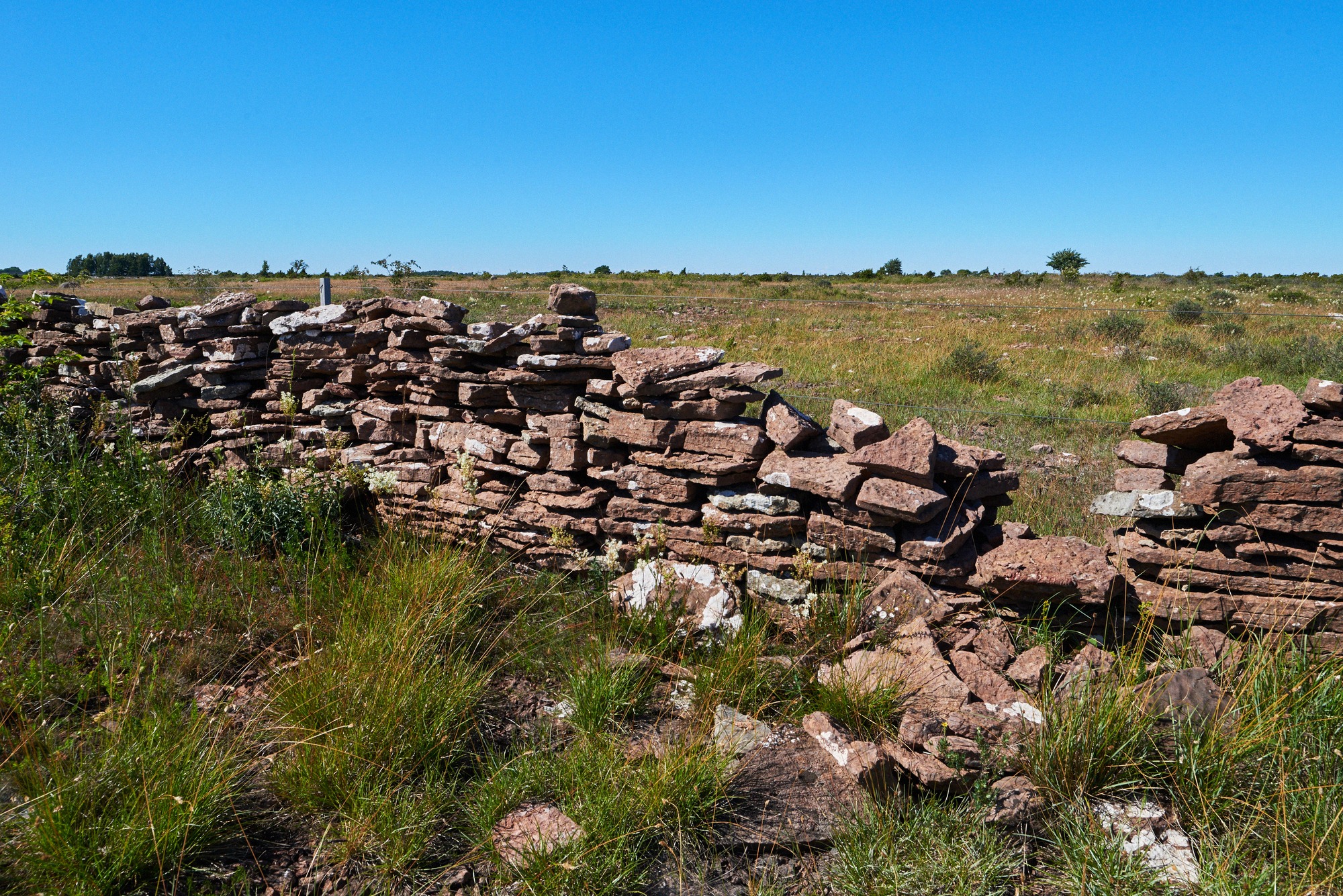
The centrepiece of the island's hiking is the Stora Alvaret, the largest continuous alvar landscape in Europe, part of the Southern Öland UNESCO World Heritage Site. Alongside the Mörbylångaleden, several shorter marked trails cross the open limestone heath. Sources cite varying sub-routes; the well-documented ones include:
- Stora Alvarleden, around 13 km from Karlevi to Möckelmossen.
- Millersten loop, starting at the Penåsa car park, 7.2 km, marked with blue posts.
- Penåsa to Tingstad flisor, about 5 km.
- Gösslundaleden loop, around 7 km, marked with stone cairns.
- Gösslunda to Tingstad flisor, about 3.5 km.
Anyone wanting the exact routing should check the official map beforehand (see below), there is no single definitive list of alvar trails with standardised distances.
Botanically, the heath is at its best from May to early June, when more than 35 orchid species are in flower. In practice, that also means there is barely any shade on the alvar. Sun protection, a hat and enough water aren't optional extras, they're essential, since fixed drinking-water points right on the trails cannot be relied on.
Two spots are useful as rest and starting points. The Penåsa car park has picnic tables and an accessible dry toilet. The rest area at Möckelmossen - Öland's largest lake, which holds water year-round, has a wind shelter (vindskydd) with seating, information boards, a barbecue area, a dry toilet and parking; a viewing platform stands around 800 metres to the north. Along the Mörbylångaleden there are also sheltered rest spots, simple toilets, fire pits and information boards. There is a low-barrier section too: the Penåsa-Skärlöv stretch follows an old railway embankment on gravel and is signed as wheelchair-accessible.
Trollskogen at the Northern Tip
Right at the northern tip lies the Trollskogen nature reserve ("troll forest"), with family-friendly loop trails. Four routes are colour-coded and vary in length:
- Knysselnackestigen (blue), 1 km, suitable for pushchairs, the shortest trail.
- Kolkyrkestigen (green), 1.3 km, with activity stations along the way.
- Murgrönestigen (yellow), 2.7 km.
- Trollskogsstigen (red), 4.5 km, a full loop of the peninsula.
The forest owes its name to its storm-bent pines and old, ivy-covered oaks, which give it a gnarled, almost enchanted look. Ecologically, the reserve is remarkably rich in species: around 300 fungi species and 155 lichen species, plus rare breeding birds such as the crested tit. One highlight is the wreck of the three-masted schooner "Swiks", which ran aground here in 1926, according to the county administrative board (Länsstyrelsen), the only place in the world with a beached slätskonare-type schooner wreck. At Naturum Trollskogen there's a café, accessible toilets, a car park and benches. The trails are generally considered family-friendly, and there's no official minimum age for children. More on the reserve is in the Trollskogen guide.
Ottenby in the South
The southern tip is rounded off by the Ottenby nature reserve, covering 995 hectares, a mosaic of forest, pasture and coastal meadows. Four marked trails open it up:
- Kyrkhamnsleden (blue diamond), 5.7 km, the longest trail.
- Norra lundleden (yellow circle), 3.9 km.
- Västra markslingan (red square), 3.4 km.
- Skogsuddeslingan (green triangle), 1.5 km, the shortest loop.
One highlight is the fallow deer, introduced here by King Johan III as far back as 1569. The best time to spot them is in autumn and winter along the Norra lundleden. Worth knowing: Ottenby has a stay-on-the-path rule with seasonal access restrictions. Certain areas are closed from 1 April to 31 August, and the western Revel area from 1 April to 15 November, so stick to the marked trails. Toilets are available at the Naturum and at the car parks, along with several day car parks (overnight stays aren't permitted) and the "Fågel blå" restaurant.
Ottenby is also one of Sweden's best birdwatching sites: with 33 species (2020 count), it holds the country's highest number of first national records. The bird observatory rings around 23,000 birds a year between 15 March and 15 November, with peak migration in the second half of May and the first half of October, on good autumn days, more than 100,000 geese and ducks pass over. The bird exhibition at the Naturum is free to visit; check naturumottenby.se for current 2026 opening hours. For more on the subject, see the Birdwatching in Öland guide, and for background on the reserve itself, the Ottenby page.
Best Time to Visit and What to Pack
Hiking season on Öland runs from May to September. The island sees relatively little snow (around 46 cm of snow and 512 mm of rainfall a year), and the trails are reliably walkable throughout the summer half of the year.
- Late May is considered the sweet spot by many, the orchids are in bloom and the mosquitoes haven't arrived yet.
- From June, mosquitoes appear, at their most aggressive early on; pack insect repellent from then on.
- May and early June are the main flowering period on the alvar.
Because the alvar is open and shadeless, and the southern tip is exposed to wind, sun protection, a hat, a windproof jacket and enough water belong in every daypack. For a broader look at the seasons beyond hiking, see the best time to visit Öland guide; for an overview of the island's nature, see the nature in Öland guide.
Getting There, Maps and the Right to Roam
For official trails and maps, Naturkartan (naturkartan.se and the app) is the best digital source; marked trails appear there as a pink dotted line. For the southern part of the island there is also the brochure "Upplev södra Öland, vandringsleder genom världsarvet", which covers the more than 140 kilometres of trail network through the World Heritage area.
Without your own car, getting around takes more planning but is possible. Local public transport is run by Kalmar länstrafik (KLT). Line 105 connects Kalmar railway station with Färjestaden, the Mörbylångaleden's starting point, in around 22 minutes, roughly every 30 minutes, and continues on to Mörbylånga. The final stretches to places such as Grönhögen, Ottenby or Näsby are covered by Närtrafiken, an on-demand call-and-ride service that has to be booked in advance. There's no guaranteed year-round service running directly to the alvar and Trollskogen trailheads, so it's worth planning transfers with some flexibility. For more on arriving in Öland, see the getting to Öland guide.
Sweden's right to roam (Allemansrätten) applies here: walking in nature is largely free and unrestricted, as long as you show consideration and leave no trace. In nature reserves such as Ottenby and Trollskogen, however, their own rules apply, including the seasonal closed zones and the stay-on-the-path rule, watch for the information boards on site.