Cycling on Öland - Routes, Bike Hire and Tips
This flat, sunny island is ideal for cycling. The Ölandsleden route, tours through Stora Alvaret, bike hire, prices and the cycle ferry.
Contents
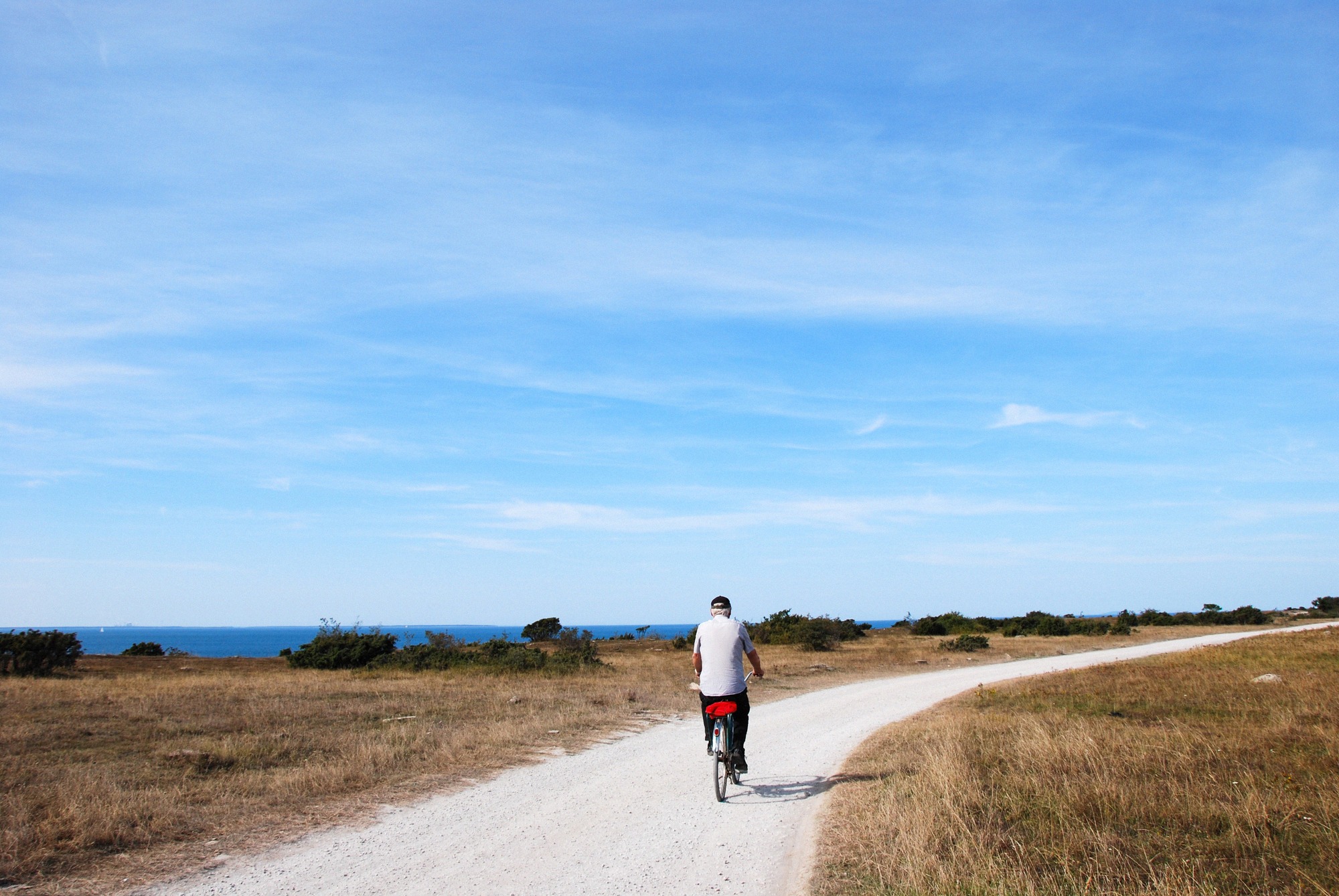
Öland is nearly flat, narrow and criss-crossed by a dense network of paths, making it one of Sweden's most relaxed islands for cycling. The official main route, several themed tours and well-organised bike hire turn a day trip into a multi-day cycling holiday with ease. The real challenge isn't the terrain, it's the wind.
The Ölandsleden, once around the island
The official main route is called the Ölandsleden, marked with yellow "Ölandsleden" signs. It circles the whole island for around 368 kilometres (Naturkartan lists 367.9 km), from the Långe Jan lighthouse at the southern tip to Långe Erik in the north. There's no official route number; you simply follow the yellow signage.
The route splits into two long main sections of 113 km and 90 km, plus several shorter marked stretches. That gives you two options: ride it complete as a multi-day tour, or break it into separate stages that you string together depending on time and accommodation. There's deliberately no fixed daily-stage plan, the Leden is designed for flexible riding.
It's rated intermediate difficulty, which is surprising given the flat terrain. Total elevation gain over the whole island loop is only around 1,446 metres. The rating comes from distance and wind, not hills.
North or south? Surface and character
The north and south of the Leden ride quite differently. The northern section runs mostly on small, often car-free paths, quiet and well suited to family cycling. The southern section shares stretches of busy main roads with traffic, so you'll want to stay more alert there.
As for surface, it's roughly 65% asphalt and 35% gravel. Most of the route is on firm roads, with gravel stretches in between, a bike with slightly sturdier tyres has the advantage, while a pure road bike is less well suited.
One notable improvement in recent years: a separate cycle path between Byxelkrok and Grankullavik was completed in 2019 (at a cost of around 16 million SEK). That means the northern loop can now be ridden in full without sharing this stretch with traffic.
Tours beyond the main route
If you don't want to circle the whole island, there are four categories of tours, the tourism portal oland.se distinguishes Cykelrundor (circular tours), Landsvägscykling (road cycling), MTB-leder (mountain bike trails) and the Ölandsleden itself. So there are dedicated road tours as well as marked mountain-bike routes.
A particularly rewarding option is a tour through the World Heritage Stora Alvaret in the south. The old railway embankment of the Södra Ölands Järnväg, built in 1910, now serves as a cycling and walking path, running straight through the unique karst and alvar vegetation, an experience you don't get from the main road. More on the landscape itself is in the Hiking on Öland guide; the alvar as a destination is covered on the Stora Alvaret page.
In the north, the area around Böda and Byxelkrok is worth the ride: here you'll find Böda Sand, an almost 3 km stretch of flat sandy beach with dunes, often called "Öland's Riviera" and one of Sweden's most popular beaches. Not far away are the limestone sea stacks of Byrums Raukar on the west coast. For an overview of coves worth using as stage stops, see the Beaches on Öland guide.
Windmills, beaches and breaks along the way
An Öland cycling trip lives on its stops along the way. The windmills are a defining feature: around 1800 there were roughly 2,000 mills on the island, and today about 351 survive, mostly post mills ("stubbmöllor"). The finest rows of mills stand at Lerkaka and Störlinge, in Lerkaka, one mill is usually open to visitors. More in the Öland Windmills guide and on the Lerkaka Windmills page.
Worth knowing when it comes to food and supplies: Öland is flatter and quieter than Gotland, its usual point of comparison, but has sparser provisioning along the route, fewer restaurants and campsites than on some other cycling islands. Böda and northern Öland have the best density, with restaurants, cafés, ice-cream stands and, along the coast (Löttorp, Byxelkrok), farm shops and snack stalls. Away from the busier spots like Trollskogen, Långe Erik and the raukar (sea stacks), it's quiet, if you're out for longer stretches, don't leave planning food and water until the last minute.
Hiring a bike, stations and prices
If you're arriving without your own bike, there are two reliable options.
- Ölands Cykeluthyrning is the largest hire operator, with around 200 bikes and about 30 models. Stations are in Mörbylånga (2 June to 31 August 2026), Färjestaden via the tourist information office (7 April to 29 September) and Borgholm (15 June to 31 August). Book by phone or online; useful for one-way rides, luggage and bike transfers between stations are possible.
- Färjestadens Cykelaffär (Storgatan 67, Färjestaden, tel. 0485-30074) hires standard bikes (Monark 3-speed) for 250 SEK/day, 500 SEK/3 days or 850 SEK for 6-7 days. E-bikes (Crescent or Cannondale with Bosch mid-motor) cost 450 SEK/day, 1,100 SEK/3 days and 1,850 SEK for 6-7 days. Helmet included; a child seat costs 50 SEK/day, panniers 20 SEK per pair per day.
Getting there by bike and the cycle ferry
You can't cycle onto the island via the Öland Bridge (Ölandsbron), cycling and walking across it are banned. Instead, in summer the cycle ferry M/S Dessi crosses the Kalmarsund between Kalmar and Färjestaden. The season runs May to September, the crossing takes around 30 minutes, and there's room for 50 bikes. It's operated by Ressel Rederi AB (tel. 073-442 44 55) in cooperation with Trafikverket and the municipalities of Kalmar and Mörbylånga. On arrival in Färjestaden, you connect straight onto the Ölandsleden.
2026 prices: adults 75 SEK, young people (13-19) and seniors 55 SEK per one-way trip; children under 13 travel free when accompanied. The bike is carried free of charge. A 10-trip card costs 505 SEK (adults) or 345 SEK (young people/seniors). Tickets are bought on board, preferably by Visa or Mastercard. All ferries, including the car ferry for the north-south crossing, are covered in the Ferries to Öland guide.
Planning around wind and weather
The terrain is nearly flat, so it's fundamentally beginner-friendly. The real challenge is the wind: Öland sits exposed in the sea with no shelter, and the most common wind direction is west to south-west. A brisk wind makes noticeable progress harder, it's best to plan your route so the longer stretches aren't entirely into the wind, and to let the wind push you west to east on a round trip.
Öland's climate plays to its strengths here. The island has a comparatively dry, sunny microclimate with around 2,095 hours of sunshine a year and only about 400 mm of rainfall, around 20 mm in the driest months (February to April), up to 50 mm in the wettest month, July. The best cycling months are June to September:
- June, relatively dry (around 4 rainy days) and with the longest daylight: around 17.5 hours of light, sunrise around 03:00, sunset around 20:45. Light nights run from roughly 28 May to 15 July.
- July, the warmest month, averaging 18.5°C, but also the wettest with around 5 rainy days.
- August and September, still mild and good for riding, with gradually shorter days.
There's no reliable cycling data for the off-season, if you're riding outside summer, check weather, daylight hours and closed hire stations locally before you go. For a full seasonal overview, see the Best Time to Visit Öland guide.